Documents: Council Packet Discussing Park Land Disposition
 |
| *Already* existing parkland at Germantown Town Center Urban Park.... |
 |
| ....is proposed as replacement for loss of parkland and urban forest at NCC Park in the BCC Planning Area. |
 |
| Park Description; Low Park Acreage/Preservation of Woodlands; Relief from Concrete and Asphalt |
In July 2014 it was then determined that if the project was to move forward there would need to be park replacement - "preferably 4 acres of MATURE FOREST adjacent to an existing Local or Neighborhood Park in the SAME PARK SERVICE AREA and SAME WATERSHED."
It was indicated the project must also provide invasive species removal and meet Tree Save and Specimen Tree Mitigation requirements.
Documents: Project Approved BUT Needs Mitigation
This begs the question --- if it was so important for the "Montgomery County" parcel of land THAT IS ALREADY NOW DEVELOPED AS A PARK between the Parks (M-NCPPC) parcels of land at Germantown Urban Park to be transferred to the Parks Department...why would they need the loss of parkland and forest at NCC Park 20 miles away to make that happen?
This land swap seems to be simply giving land from the right hand to the left hand and counting it as a net gain (even though the exchange doesn't even meet "fair market value" requirement). And, as the Executive Order states, the County had no need to retain its portion of the Germantown parkland anyway.
 |
| From the Executive Order |
County Park Service Map: Proposed Park Replacement is in a DIFFERENT PARK SERVICE AREA.
County Watershed Map: Proposed Park Replacement is in a DIFFERENT WATERSHED AREA.

County Recreation Map: Proposed Park Replacement is in a DIFFERENT RECREATION AREA.

Video of Planning Board hearing in 2014: "DOT wants money to spend on asphalt; instead of improving parkland." DOT (fortunately) unsuccessfully argued against also having to provide invasive species removal at NCC Park as part of mitigation. Disturbing and fragmenting a forest can lead to more invasive species entering an area. It was determined they do need to provide invasive species removal.

Video of Planning Board hearing in 2014: "DOT wants money to spend on asphalt; instead of improving parkland." DOT (fortunately) unsuccessfully argued against also having to provide invasive species removal at NCC Park as part of mitigation. Disturbing and fragmenting a forest can lead to more invasive species entering an area. It was determined they do need to provide invasive species removal.
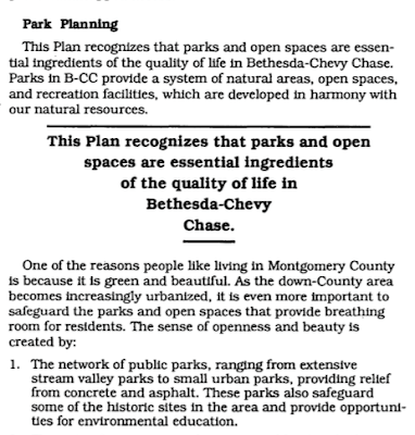
After the new Bethesda Plan recently promised more green space, tree canopy, and parkland - this land swap is moving in the wrong direction towards a continued net loss of parkland for the local area. So why not contribute to parkland back in the local area (where many parks have been identified as needing expansion and improvement)? This story will be updated following the Council discussion and decision.
UPDATE: The Council determined more local mitigation should be provided and agreed to additional stormwater management improvements, invasive plant removal, and tree plantings in an area of North Chevy Chase Park! These improvements will happen in 2018 and 2019!
 |
| Germantown Town Center Urban Park is wonderful! But is should not count for loss of urban forest and parkland 20 miles away. |
 |
| 1990 Bethesda Chevy Chase Plan |


